Select a language:

Thursday Morning Trek: Baker Canyon

This week in OC Parks’ Irvine Ranch Open Space, we’ll hike in Baker Canyon. This scenic hike includes steep climbs and descents on both single and double track trails with about 1,100 feet of accumulated climbing. We will enjoy sweeping views of the Irvine Ranch Natural Landmarks and the Santa Ana Mountains. On clear days, we can see Catalina Island and even beyond into the Los Angeles Basin. Please wear hiking shoes/boots and bring water, a trail snack, sun screen, hat and any other necessary equipment to keep you safe on the trail. Participants must be able to hike 7 miles with an elevation gain of 1,100 feet at an average moving rate of 3 mph. Each hiker must carry their own water and supplies.

Please note that you will be asked to adhere to the following measures in order to participate:

  • Be registered in advance, no walk-up registration is permitted.
  • Arrive with all necessary equipment to keep you safe on the trail, including water, proper attire, and closed-toe footwear, first aid, health needs etc.
  • Restrooms will be available, but facilities will not be sanitized for each individual.
  • All participants are required to sign a liability waiver upon arrival at the staging area and before beginning the activity. The waiver can be previewed here: IRC Liability Waiver
  • You may be prevented from participating if you do not adhere to the above protocols.

Additionally, in an effort to respect and protect all employees, volunteers and participants, please do not sign up or attend if you are not feeling well, exhibiting any symptoms of illness or have been in recent contact with someone who was ill.

Reviewing the 1-through-5 Difficulty Ratings will help you evaluate your readiness to participate in this level-4 activity on the land. Please visit our FAQ page for answers to activity specific questions you may have prior to registering.

Learn more and register here.

Thursday Morning Trek: Baker Canyon

Demonstration Garden Maintenance: Native Seed Farm

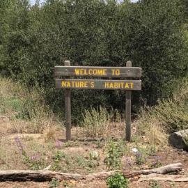
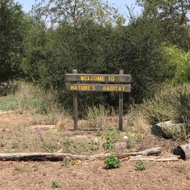
Visitors to IRC’s Native Seed Farm are first greeted by our Demonstration Garden, providing inspiration for regionally suitable plant gardens. Our garden hosts a variety of native plant species which support a healthy local ecosystem!

IRC Volunteers are invited to help at our monthly Garden Maintenance Day! Our tasks each day are to be determined, but we’ll be tackling whatever jobs are a top priority to keep our Garden teeming with native plant life. Weeding, clearing, cutting, digging, watering, whatever it takes! Activities may include bending, stooping, crouching, squatting, long periods of standing, reaching, pulling, grabbing, and pushing.

Just like all settings on the Landmarks, please always be aware of your surroundings. There may be unseen and hidden dangers in the area, as well as wildlife crossing through finding refuge. Please be sure to follow all instructions provided to you from your lead during this activity and follow standard trail protocols, including remaining in areas that are designated for your use only.

Learn more and register here.

Native Seed Farm

Mile Square Regional Park Expansion - Phase 2

Mile Square Regional Park Phase 2


The Mile Square Regional Park 93-acre Expansion Area will be closed to commence construction of Phase 2. New additions coming to the park to include an Amphitheater, Great Meadow, Children's Adventure Play Area, Multi-Use Field, Primary Vehicular Road, Parking and Restroom Building.

WHEN:

93-acre closure begins September 23, 2024.  Anticipated completion is Fall 2026. 
Schedule is subject to change due to weather or other factors.

CONTACT INFORMATION:

Shannon Widor, OC Public Works
(714) 667-9759
Shannon.widor@ocpw.ocgov.com 


OC Parks Encouraging Community-Led Shoreline Monitoring in Dana Point

CoastSnap phone cradle at Strands Beach

(Dana Point, Calif.)  OC Parks recently installed the first community-driven shoreline monitoring location in Orange County. Located along the Strands Beach access ramp (map included in Press Images), the CoastSnap station encourages community members to help with coastal monitoring efforts. 

The CoastSnap station includes a smartphone cradle and instructions on how to upload and submit a photo of the shoreline. Residents and visitors alike are invited to place their phones in the cradle and snap a photo. The cradle is set at a precise location and angle to ensure the public is capturing consistent images. Afterward, the public is asked to scan a QR code to then upload the photo. From there, the images are sent to OC Parks and will be used to assist with monitoring seasonal and long-term beach width. The cradle works in conjunction with surveyed control points and time stamps allowing for photos to be stitched together, accounting for tidal variations.

“I am excited to bring the first CoastSnap station to Orange County and harness the power of the community to help protect our coast,” said Supervisor Katrina Foley, Orange County Board of Supervisors. “Coastal erosion threatens our coastal communities, economy and way of life here in Orange County. This CoastSnap station serves as a valuable tool to measure how much coastal erosion impacts our beaches. By engaging residents in this important endeavor, we will gather valuable data while serving as good stewards over our beaches.”

CoastSnap, developed by researchers from the University of New South Wales (UNSW Sydney), is a global citizen science project to help researchers better understand the coastlines and safeguard them for future generations. Currently, there are five other CoastSnap stations in California located in San Diego County. In addition to the CoastSnap station, a new interpretive sign has been installed complementing the CoastSnap station with narrative descriptions and images demonstrating seasonal and long-term changes of the shoreline.

The installation of the CoastSnap station marks the completion of the Niguel Shores Revetment Restoration Project. As part of the Coastal Development Permit issued by the California Coastal Commission for this project aimed at enhancing shoreline protection, OC Parks is responsible for complying with a Shore Zone Monitoring Plan. Seasonal transect surveys will be conducted to monitor any movement of the revetment and photos collected through the CoastSnap station will further aide in these efforts. 

Read this release in:

###

OC Parks

OC Parks manages nearly 60,000 acres of parks, historical and coastal facilities and open space for the County of Orange as part of OC Community Resources. http://www.ocparks.com

Morning Mountain Bike Ride at Red Rock Wilderness

Join an intermediate-level ride on OC Parks’ newest trails in the recently opened Red Rock Wilderness!

This ride will be moderately paced and include a mix of sustained singletrack climbs and fun twisty descents. Participants will reach a ridgeline lookout with panoramic views of Black Star Canyon, Santiago Canyon and Irvine Lake. Periodic breaks and trailside interpretation will be sprinkled in along the way. This ride will be approximately 8 miles with 1,000 feet of elevation gain.

Reviewing the 1-through-5 Difficulty Ratings will help you evaluate your readiness to participate in this Level 3 activity on the land. Motorized recreation vehicles of any class or type are not permitted for use in the park and participants must provide their own mountain bikes and helmets to participate.

Participants should come prepared with water, snacks, sun protection and any other gear needed for a ride in a remote area. Minors must be experienced and capable riders, wear helmets and be accompanied by a parent or guardian at all times to participate. Rain or adverse weather conditions will cancel the program.

Advance registration required. Learn more and register here.

Morning Mountain Bike Ride Red Rock

Capistrano Beach Sand Nourishment Project

Aerial view of sand placement area at Capistrano Beach

This project has been completed

Placement of up to 20,000 cubic yards of sand material from the Santa Ana River, from OC Public Works, at Capistrano Beach within the City of Dana Point. This is a joint project between OC Parks and OC Public Works. Public access may be limited during construction.

What:

•    Transport of 20,000 cubic yards of clean sand removed from flood control maintenance in the Santa Ana River.
•    Screening of sand and trucking to the beach area north of Palisades Drive.
•    Placement of sand along a 550 linear-foot stretch at the north reach of Capistrano Beach.

DETOURS AND SAFETY
Flaggers will direct both pedestrians and bicyclists to avoid the work area. Watch for additional traffic control measures including construction signage.

BACKGROUND
Additional sand serves to counter coastal erosion, protect coastal resources and enhance recreation areas. The California Coastal Commission (CCC) has approved placement of sand as an interim measure.

When:

Anticipated Construction Duration:
July 8 – September 2024

Working Days/Hours:
Monday – Friday, 7 a.m. to 5 p.m.

Working hours and schedule will vary due to tides, inclement weather, ocean conditions and other factors.

Where:

Capistrano Beach Park
35005 Beach Road, Dana Point, CA 92624

Contact Information:

(714) 973-6865

ocparks@ocparks.com

Guided Mindful Nature Walk

Join OC Parks staff and volunteers to observe the sights, sounds and smells of nature during an intimate nature walk led by a certified nature and forest therapy guide. Through a series of invitations, you will be encouraged to explore in the present moment and deepen your connection with nature.

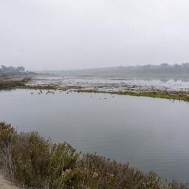
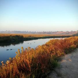
Experience the benefits of spending time outdoors in a mindful way during a lovely morning at Upper Newport Bay. Please note this is a slow-paced program designed for ages 16 and older. 

Please wear comfortable attire and closed-toe shoes. The program and parking are free. Adverse weather will cancel the program.

Advance registration required. Learn more and register here.

For questions, please contact resource specialist Emma Arago at emma.arago@ocparks.com or call (949) 923-2277.

sunrise upper newport bay

Guided Mindful Nature Walk

Join OC Parks staff and volunteers to observe the sights, sounds and smells of nature during an intimate nature walk led by a certified nature and forest therapy guide. Through a series of invitations, you will be encouraged to explore in the present moment and deepen your connection with nature.

Experience the benefits of spending time outdoors in a mindful way during a lovely morning at Upper Newport Bay. Please note this is a slow-paced program designed for ages 16 and older. 

Please wear comfortable attire and closed-toe shoes. The program and parking are free. Adverse weather will cancel the program.

Advance registration required. Learn more and register here.

For questions, please contact resource specialist Emma Arago at emma.arago@ocparks.com or call (949) 923-2277.

Reach for the Heights on Little Sycamore Trail

Fitness Hike - Wood Canyon

*This program begins at Canyon View Park, 22144 Canyon Vistas, Aliso Viejo, CA 92656 *

Please be aware this is a fitness hike and not for beginners; the pace is approximately a19-minute mile.

Raise your heart rate and your spirits on this strenuous, fast-paced, 6.2-mile hike over steep and uneven terrain with approximately 800 feet of elevation gain with Laguna Canyon Foundation volunteers.

Advance registration required. Learn more and register here.

Please review safety precautions and protocols when registering. 

For questions call 949-497-8324 on weekdays or 949-923-2200 on weekends. 

This hike begins at Canyon View Park, 22144 Canyon Vistas, Aliso Viejo, CA 92656.

Free street parking is available. 

Dilley Fitness
Subscribe to