Select a language:

Tri-City Regional Park Improvements in Progress

Small lake surrounded by grass, rocks and trees


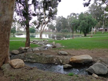
Construction on new restrooms and an exercise course are underway at Tri-City Regional Park.

Restroom #1 is currently closed and being replaced with a new restroom building. Once it is complete and open, currently estimated in April of 2021, Restroom #2 will close for replacement. Estimated completion date for Restroom #2 replacement is December, 2021.

Construction on a new exercise course is also ongoing. This is estimated to be completed summer, 2021.

Poche Beach Bridge Emergency Closure

The Poche Beach bridge off PCH and Camino Capistrano is closed.

Public access through this point of entry to the beach and beach club is closed due to dangerous conditions on the bridge.

Fall-Winter Operating Hours Begin November 1

The clocks fall back early Sunday, Nov. 1, marking the end of daylight-saving time and OC Parks’ spring-summer operating schedule. Most regional parks close at 6 p.m. for the fall and winter, and wilderness parks close at sunset. Make sure to check our COVID-19 information page for modified operations at some parks.

Fall-winter hours for the following regional parks are 7 a.m. to 6 p.m.:

  • Carbon Canyon Regional Park
  • Clark Regional Park
  • Craig Regional Park
  • Laguna Niguel Regional Park
  • Mason Regional Park
  • Mile Square Regional Park
  • Tri-City Regional Park
  • Yorba Regional Park
  • Irvine Regional Park (opens at 6 a.m.)

Wilderness parks and the following regional parks are open at 7 a.m. and close at sunset year round:

  • O’Neill Regional Park
  • Peters Canyon Regional Park  
  • Santiago Oaks Regional Park
  • Aliso and Wood Canyons Wilderness Park
  • Caspers Wilderness Park
  • Laguna Coast Wilderness Park (parking lots open at 8 a.m.)
  • Riley Wilderness Park
  • Talbert Regional Park
  • Whiting Ranch Wilderness Park
  • Wieder Regional Park
  • Upper Newport Bay Nature Preserve
  • Irvine Lake will continue to operate Friday-Sunday 7 a.m. to 4 p.m.
Hours for OC Parks’ beaches vary, but are generally between 6 a.m. and 10 p.m. Salt Creek Beach opens at 5 a.m. and closes at 12 a.m. Thousand Steps Beach opens at 6 a.m. and closes at 9 p.m.

OC Parks facilities will remain on these operating hours until daylight-saving time returns March 14, 2021 and will run through Nov. 7, 2021. Make sure to check our COVID-19 information page for modified operations at some parks.

Information Regarding Unauthorized Trails

Grass lined dirt trail with a "Do Not Enter" sign

OC Parks serves as the steward of 60,000 acres of County parks, beaches and open space. This stewardship involves the protection and preservation of sustainable, healthy habitat both for generations of future visitors and also the local wildlife that live in it.

The County’s regional and wilderness parks and open space offer hundreds of miles of existing trails for pedestrian, bicycle and equestrian uses. Building and use of unauthorized trails, however, remains an ongoing issue.

These unauthorized trails cut through preserved habitat and jeopardize public access, native habitat and wildlife. In many parks, OC Parks does not even have the discretion to allow or disregard unauthorized trails; it is bound by state and federal agencies to preserve the land.

Here are some of the top reasons to stay off unauthorized, unmarked trails.

Protect your access!

Creating and using unauthorized trails can lead to loss of public access to parkland. In some cases, multiple layers of restrictions legally protect areas designated as conserved lands. Agreements with California Department of Fish and Wildlife and U.S. Fish and Wildlife Service allow for public access in these areas, second only to habitat and resource protection. Recreation is permitted only when it can occur without impacts to habitat and wildlife.

Authorized trails as designated on official park maps and signage, were adopted into the parks’ General Development Plan (GDP) and Resource Management Plan (RMP) after extensive research and surveys by biologists to determine those that would have the least impact on the sustainability of the environment.  OC Parks is obligated to maintain the land in accordance with our management obligations as outlined in the GDP and RMP, which includes a list of the trails and areas that the public may access.  The County (OC Parks) is subject to steep fines and may be pressured to reduce public access by these regulatory state and federal wildlife agencies.

Protect biodiversity!

While it may not be apparent to the untrained eye, many unauthorized trails travel through some of the most environmentally sensitive and fragile habitat, home to several threatened and endangered species.

Even though an authorized trail may sometimes be wide, its environmental impact is far less significant since many were originally ranch roads that have existed for over a hundred years. By intentionally utilizing these historic alignments, our trail systems take advantage of areas that are already devoid of native plants rather than destructing existing, intact natural habitat.

Trail cutting and the use of unauthorized trails reduces living space for wildlife, allows invasive weeds to creep deeper into untouched wilderness, damages overall habitat health and potentially jeopardizes the public’s right to regularly access these special areas.

Honor the past, present and future of our wildlands!

Some parks and open space, including Laguna Coast and Aliso and Wood Canyons wilderness parks remain as parks today only because of hard work and environmental advocacy to preserve the land. The area where those are now enjoyed by many were slated for development and homebuilding. Through years of activism, including a tax bond Laguna Beach voters passed to purchase the land, these parks are now protected in perpetuity. OC Parks works to preserve these lands and allow recreation that will keep them vibrant and healthy for future generations to enjoy.

So we can’t ever have new trails?

OC Parks works hard to balance resource protection with public recreation. This often involves a give-and-take of one trail for another, an awareness of what areas have specific environment and archeological sensitivities and protections, and what sections may be more appropriate for increased use. OC Parks has worked with stakeholders to add trails into the system under the correct circumstances, including Car Wreck Trail at Aliso and Wood Canyons Wilderness Park; Lizard Trail at Laguna Coast Wilderness Park; and Water Works, Las Flores Ridge and Ladera Ridge trails at O’Neill Regional Park.

How do you decommission an unauthorized trail?

Decompacting trail tread is a common technique used to close trails. Shallow holes are dug the length of the trail in order to trap native seeds and water in order to initiate and speed up the restoration process. Additionally, the trail tread is broken up with pick axes and native seeds and cactus are added along the trail tread.  The final step is to cover the old trail alignment with native brush, which screens the trail and speeds up the germination of the native seed bank and improves restoration success.

What can I do?

The best way to help keep parks and trails healthy is by not creating or riding unauthorized trails or modifying existing trails without approval. If you see anyone else doing so, please report it to park staff.

We welcome constructive input from stakeholders and park users. You may contact us at OCParks@OCParks.com.

Read More

2020 Catfish Stocking Schedule by Week

Upcoming catfish stocking schedule by week for Irvine Lake, Carbon Canyon, Craig, Clark, Tri-City, Irvine, Laguna Niguel, Mile Square and Yorba regional Parks.California fishing license required* and all California Department of Fish and Wildlife rules apply.(*license not required at Irvine Lake) read more

View PDF

OC Parks Top 3: Scenic Spots

OC Parks includes more than 60,000 acres of parks, historical and coastal landmarks, and open space that are full of breath-taking views and hidden gems. Grab your camera and come out to explore these landmarks.

Here are our top 3 picturesque photo spots throughout OC Parks, and how to get there. Watch our video for more information. Make sure to plan accordingly, wear appropriate footwear, bring plenty of water, protect yourself from the elements and follow all park rules.


  • Red Rock Canyon at Whiting Ranch Wilderness Park
    • This hike is approximately 4 miles round trip with minimal elevation change.
    • The parking lot is located at 26701 Portola Parkway, Foothill Ranch, CA 92610. It is on Portola Parkway, between Bake and Alton.
    • Proceed to the entrance of Borrego Canyon Trail.
    • After hiking for about 1.5 miles, you will come to an intersection with a sign board, continue to the right. There is a map posted in this area that you can reference.
    • You will briefly walk on Mustard Trail, but quickly come to the trail head for Red Rock Canyon. Turn left and continue hiking for about .5 miles. Portions of this trail are very rocky.
    • The sandstone cliffs are very fragile and can be dangerous to climb. Please help up us protect this unique canyon, as well as park visitors, by staying on trail to enjoy the view.
    • Whiting Ranch is protected habitat in a wilderness park, so no dogs are allowed on the trails.
  •  Boat Canyon Hike at Laguna Coast Wilderness Park
    • This hike is 4.3 miles each way, so 8.6 miles roundtrip with steep climbs.
    • Park in the Big Bend parking lot, just off of Laguna Canyon Road.
    • Hike 1.5 miles up Big Bend. This is very steep.
    • At the top of Big Bend (post 12), turn left onto Bommer Ridge; hike 1 mile on Bommer Ridge.
    • At the junction with Boat Road (post 15), turn right; hike 1.3 miles on Boat Road.
    • Boat Road becomes Guna Peak Trail (at post 18); hike .5 mile on Guna Peak Trail.
    • At the end of Guna Peak Trail is a great overlook; there’s a bench for relaxing and enjoying the spectacular views up and down the coast.

  •  Redwood Grove at Carbon Canyon Regional Park

    • From the beginning of the Nature Trail from Parking Lot F (east end), it is 1.1 miles one way to the Redwood Grove.
    • If you start the excursion from Parking Lot A (west end) trailhead, it is approximately ½ mile to the Redwood Grove. If you take this route, there is less scenery. You will miss the Butterfly Garden and the corral area filled with native plants and newly planted trees.


NOTICE: Yorba Regional Park Shelter Roof Repair Project

OC Parks and OC Public Works is currently working to obtain a cost estimate for the Yorba Regional Park shelter roof replacement. A cost estimate will be obtained soon.

If you have any questions, please contact Marie Moreno, OC Parks Customer Service Manager, at 949-585-6431.

OC Parks Top 3 Video Series

Want to learn more about different aspects of OC Parks? Each month we bring you a Top 3 things to know about different topics in OC Parks.


Laguna Niguel Pavement Rehabilitation October-February

OC Public Works, on behalf of OC Parks, will complete a pavement rehabilitation project within Laguna Niguel Regional Park located in the City of Laguna Niguel. Park users may experience an increase in construction-related noise and dust during regular working hours. The work activity will be completed in phases, utilizing traffic control and flag personnel which will allow park users to utilize the majority of the park during construction. Park users are advised to adhere to all traffic control signage. All construction activity will occur on weekdays. read more

View PDF

Subscribe to